


Overview
Purpose-built for enterprise reporting, Icon Map Pro brings high-performance, multi-layer spatial analytics into the hands of everyday Power BI users, without the need for specialist GIS tools. It extends Power BI to deliver advanced geospatial visualisation, with support for data-bound circles, clusters, icons, images, lines, polygons, H3 hexagons, and heatmap layers. By incorporating reference layers, you can overlay critical geographic context and make your analysis more meaningful. Designed for Microsoft Power BI, it offers a familiar, intuitive interface to create complex maps at speed and scale.
Data-Bound Items
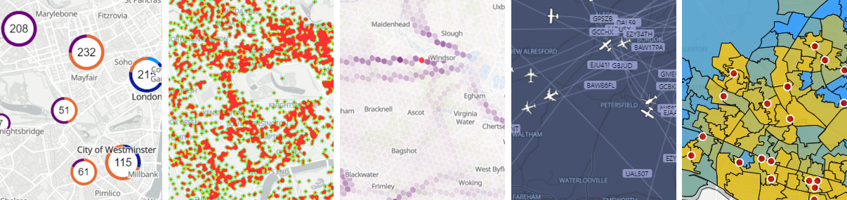
Icon Map Pro enables you to draw an impressive range of different types of objects on your map, and locate and format them based on data in your Power BI semantic model.
The different types of data-bound items include:
- Circles - including clustering
- Images - from external URLs or data:// URLs including SVG support, with optional clustering
- Lines - straight, curved and geodesic.
- Heatmaps
- H3 hexagons - from point data or H3 indexes
- Shapes stored in your Power BI dataset in Well Known Text (WKT) or GeoJSON format
- Shapes loaded from externally hosted files in ESRI Shapefile, KML or GeoJSON format
- Shapes uploaded from local files in ESRI Shapefile, KML or GeoJSON format
- Shapes loaded from vector tiles
- Shapes sourced from ESRI ArcGIS feature layers
All with comprehensive support for Power BI's conditional formatting options.
Configure multiple fields for your tooltips or use report page tooltips. Power BI's Cross-highlighting, cross-filtering and drill-through are all supported.
Drill-down through multiple levels of circles, H3 hexagons (with H3 Indexes) or shape layers.
Add multiple layers of shapes, whether from files, ArcGIS or vector tiles, all bound to your Power BI dataset, and apply different formatting options to each layer.
Work with longitude and latitude coordinates or specify a specific coordinate reference system (CRS) (eg British National Grid eastings and northings) for your source data and the coordinates are automatically translated to longitude and latitude coordinates and displayed on the map.
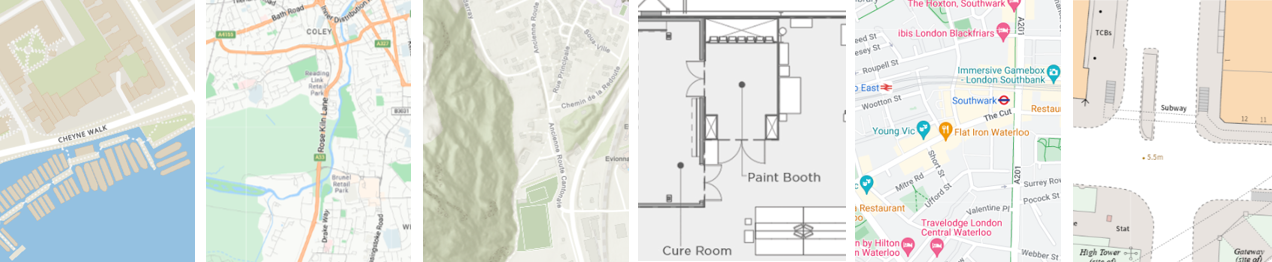
Map Backgrounds
Icon Map Pro, Azure Maps, ESRI, Mapbox, Google Maps, Ordnance Survey
Icon Map Pro comes with its own background mapping built from OpenStreetMap data and is available in a number of styles.
Map Styles
Try different background styles by clicking on the thumbnails above
If you would like to include a third-party's background maps within your report, then we have pre-configured support for:
- Azure Maps
- ESRI ArcGIS
- Google Maps
- Mapbox
- Mappable
- MapTiler
- Ordnance Survey
You will need to provide an API key from the third party provider in order to use these services.
In addition to Icon Map Pro's background mapping and the pre-configured third party providers, it's possible to add your own custom URLs supporting a wide range of additional providers and services:
- Raster tiles
- Vector tiles
- Custom image - Create indoor maps, plans and diagrams using non-geographic coordinates.
- WMS layers
Overlays and Reference Data
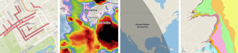
Traffic from Azure Maps, Weather from Azure Maps, Daylight Terminator, WMS - from British Geological Survey
Icon Map Pro provides the ability to add additional reference information overlaid on top of the background map.
Examples include:
- Place names
- Daylight terminator
- Shapes loaded from an external URL or uploaded file
- Custom maps layers from raster or WMS sources
- ESRI ArcGIS feature layer
- Traffic from Azure Maps and Google Maps
- Weather from Azure Maps and OpenWeatherMap
ArcGIS, traffic and weather layers require a third party API key.
Add multiple layers of shapes, ArcGIS feature layers and WMS sources. Dynamically filter WMS layers to only show the items your need using Power BI's conditional formatting. Expose property names as standard Power BI tooltips.
Controls
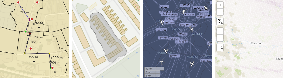
Distance measurement tool, Lasso, Scale, Control icons
Icon Map Pro provides a number of map controls adding additional interaction options, or ability to interpret the map.
- Zoom
- Zoom lock - temporarily disable auto-zoom from cross-highlighting and filtering
- Scale in metric, imperial and nautical units
- Lasso tool to select specific elements (in addition to multi select)
- Distance measurement tool
- Attribution - add map attribution text to ensure compliance with third-party providers.
New releases: By default, when you use Icon Map in the Power BI service, Microsoft applies the latest version through AppSource, you don’t need to download or install the visual yourself. If you use Icon Map in Power BI Report Server, you must manually download each new release and install it. Get builds from our Icon Map Pro releases page. You can also install preview releases from that page, typically up to two weeks before they appear in AppSource.